Working in the conflict zones of Syria, Northern Iraq, and Libya, the ASOR Cultural Heritage Initiatives (ASOR CHI) documents, protects, and promotes global awareness of at risk cultural property, including museums, libraries, and archaeological, historic, and religious sites.


ASOR CHI issues monthly reports to the U.S. Department of State, which are redacted and posted online. These reports outline the status of damage and threats to cultural heritage in conflict zones. In addition to the U.S. Department of State, Principal Investigator Michael Danti explains that they have been used by a range of other organizations, including UNESCO, Interpol, and Europol. “We engage in public outreach working to alert the public to what's going on in the conflict zone and to better inform policy makers and decision makers on cultural property protection and potential cultural diplomacy and cultural policy decisions,” Danti says.
Protecting Cultural Heritage in the Conflict Zone
Syria, Northern Iraq, and Libya are rich in cultural heritage, including UNESCO World Heritage Sites and a wide range of less famous but no less significant sites, texts, and objects from pre-Islamic, Islamic, Christian, Jewish, and other regional cultural groups.
ASOR CHI works with stakeholders in the Middle East to protect all cultural property from both accidental and deliberate destruction, as the region remains engulfed in conflict.
“We're not obsessed with old stones and bones,” Danti says. “We're doing this because we all worked in the conflict zone and we're helping our colleagues. They're risking their lives to do this and this is what we do best, so we're trying to make a difference.”
ASOR CHI understands the protection of cultural heritage to be a matter of crucial importance.
“We see what we're doing as a highly integrated and inextricable part of a larger humanitarian effort. It's really integral to that larger humanitarian effort and it moves in lockstep forward with it,” Danti says. “We see access to cultural heritage and cultural expression as a fundamental human right that… has been deliberately attacked and/or suppressed through the course of this conflict.”
Data-Driven Cultural Heritage Protection
This immense and critical undertaking has three major components: open source, human source, and geospatial data collection.
“On a daily basis, we have a team grabbing up all the data that is out there on this horrific cultural heritage catastrophe—the worst since World War II,” Danti explains.
“We do that through the collection of open source information from social media, websites, and traditional media sources. We gather together human source information from people in the conflict zone and expat Syrians, Iraqis, and Libyans.”
The collection of geospatial data includes two initiatives.
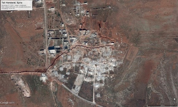
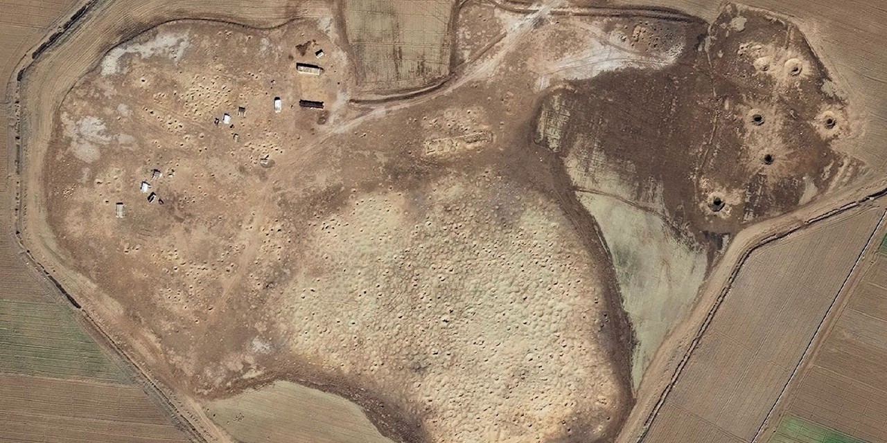
The first uses the latest available satellite imagery to assemble weekly reports on the state of cultural heritage in the conflict zone.
“We have a team that analyzes high-resolution satellite imagery and other geospatial datasets,” Danti explains. “Our program was granted access to a massive database of high-resolution satellite imagery [from the State Department] that is updated on a daily basis. We are also able to task those satellites to specific sites that we need images of.”
The process involves frequent analysis of satellite imagery from the Middle East, Project Manager for Geospatial Initiatives Susan Penacho explains.
“We created a large database of sites in each of these countries that we go through to check on their status,” Penacho explains. “We prioritize based on coverage we're getting of what’s happening on the ground. We follow the military, so we're constantly shifting what we're assessing.”
The second initiative involves higher education faculty and students at University of California campuses in Berkeley, Merced, and San Diego.
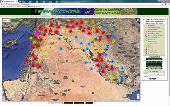
Through a collaboration with Stephen Savage and the crowdsourcing platform TerraWatchers, faculty at these UC campuses enlist their students in the protection of cultural heritage.
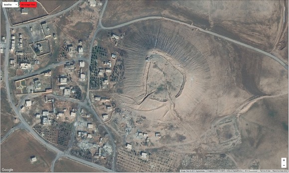
Using an augmented Google Maps interface to analyze publicly available older satellite imagery from Google Maps and DigitalGlobe, students are trained to seek out, identify, and tag signs of damage in areas of the conflict zone that Penacho and her team are not actively monitoring.

When the preliminary assessments identify signs of damage, the student work is vetted internally, and, if confirmed, passed on to human intelligence to be checked against the facts on the ground.
A Mutually Beneficial Partnership with Higher Education
The classroom geospatial work not only contributes to the ASOR CHI mission, but also creates opportunities for training in cultural heritage preservation and protection.
This offers both tactical and longer term advantages. In the short term, working with students helps the project work through vast fields of data, Danti explains. “Crowdsourcing and bringing in educational institutions to increase capacity and to be scalable is extremely important. They really give us the upper hand. We have to think on our feet and be adaptive. What's happening on the ground is that the non-state actors are highly adaptive themselves. We have to match that. Unfortunately, culture is in the crosshairs, so we have to adapt on the fly.”
In the longer term, Danti explains that collaboration with educational institutions builds capacity to adapt to changes in archaeology and cultural management in the Middle East and North Africa region.
“One of the things that our involvement with education is doing is it serves as a kind of stop-gap measure. Given that it takes a while for people to change curricula, syllabi, get courses approved, and make new hires, it's going to take a while before we gear up for these changes that we're seeing in the cultural sector and higher education. Our public outreach and educational initiatives provide some of that.”
